

Full Curriculum
Unit IV: Israel in Focus
Lesson 3: The Land of Israel
| Time: | 50 minutes |
| Materials: | One copy of Israel worksheet 3A “Land of Israel: Map Activity” packet (six pages) Six fine-tipped markers or pens in different colors Classroom board One copy of Israel worksheets 3B “Land of Israel: Jewish Texts” packet (nine pages) Printed copies of photographs by Zion Ozeri of different locations in Israel:
Tape or thumbtacks (to display photographs and names on the classroom walls) |
| Big Idea: | The Land of Israel is intrinsically special to the Jewish people. Israel is not just a setting in the story of the Jews; it is like a living character as well. What role does the Land of Israel play in the history of the Jewish people, and what are our responsibilities to the Land? How would the story of the Jewish people be different without Eretz Yisrael? |
| Learning Objectives: | In this lesson, students will:
|
Warm-Up/Introduction Activity (15 minutes)
- Prior to class, arrange the desks into six groups, and at each set of desks place one page from the “Land of Israel: Map Activity” packet along with a different color marker or pen.
- Once students are seated, instruct them to read the question that accompanies their group’s map, discuss it as a group, and then write their responses inside the shape of Israel. Give students a couple of minutes to respond, and then ask them to pass their paper to the group to their left. The next group should read the question and the previous group’s comments, and then add their responses. Repeat the activity until all groups have responded to all six questions. (You may discuss these responses in a future class and/or display them in the classroom for students to read at their leisure.)
- Explain to students that in today’s lesson they will be exploring the concept of Eretz Yisrael ( ) – the Land of Israel – both as a physical location and as something that is precious to the Jewish people.
Text Activity (15 minutes)
- Divide students into nine pairs or groups, and give each group a page from Israel Worksheet 3B: “Land of Israel: Jewish Texts.” Ask students to read their text, discuss it, and answer the questions. Circulate among the groups to address any questions students may have or to redirect them.
- As students work, tape or pin up the fourteen photographs of different locations in Israel around the room, along with the name and location of each.
- When each group finishes, instruct students to walk around the room quietly, look at the photographs as a group, and then choose one photograph that they feel best reflects the significance of Eretz Yisrael depicted in their text. They should take the photograph back to their desks.
Photo Activity (15 minutes)
- Ask students to discuss in their groups how they think their photograph is related to their text. Students should revisit their worksheet responses and answer the same questions for the photograph. How does the photograph speak to the meaning behind the text?
- Then, ask students to imagine they are standing at the location of the photograph when it was taken. What sights, sounds, smells, and physical feelings do they have standing in this spot? How connected do they feel to the land and to Israel? Why?
- Ask students to share their texts, photographs, and connections briefly with the rest of the class. If necessary, continue this activity in the next class.
Wrap Up/Review (5 minutes)
It is said that “a picture speaks a thousand words.” If these photographs could speak, what would they tell us about their piece of the story of Israel?
Homework:
Each student should choose a special place that he or she can easily visit (such as a room in his or her home or the home of a family member, a spot in the backyard or a nearby park, or another easily accessible location). Students should photograph their places in a way that they feel captures what is special to them about it. Each student should then write a brief (one page) story about the place, either as a personal reflection or as a first-person narrative from the perspective of the location. Photographs and stories can be shared in a future class.
Extension Activities:
- Think about the many ways that Israel is characterized in Jewish tradition and texts, as well as in modern perceptions (such as the “land of milk and honey,” the “promised land,” a homeland or refuge for Jews from around the world, and a leader in technological advancement, to name a few.) Choose one of these concepts and consider how Israel might be personified based on this concept. Is Israel a parent? A teacher? A doctor? A policeman? Write a creative essay focusing on this personification of Israel.
- Many Hebrew songs are about specific places in Israel, the history of Israel, or the importance of Israel to the Jewish people. Listen to some of these songs on the Internet. Then, choose one and create a visual aid (poster, PowerPoint presentation, storybook, etc.) that incorporates photographs to show the meaning behind the song.
- Show maps of the countries in the Middle East as well as countries of the Middle East and Europe, so students can have a perspective on the size of Israel in relation to neighboring countries. (Map of Middle East & Europe)
If your students have not yet done the Introductory Lesson, we recommend beginning with that lesson before progressing through the lessons in this unit.
IMAGES
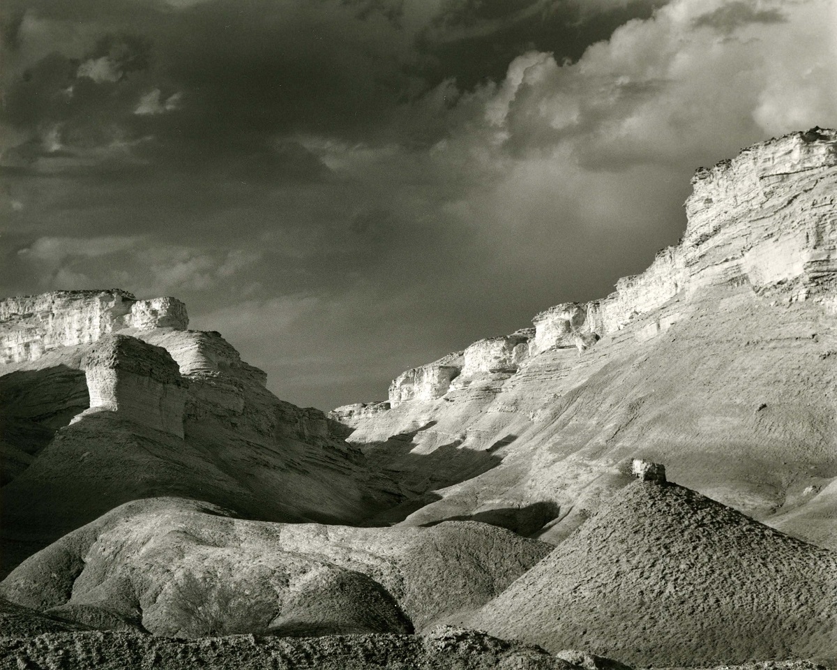
Amiaz Plains, Israel 2002
All images © Zion Ozeri. All Rights Reserved.
The Amiaz Plains rise to the west of the Dead Sea.
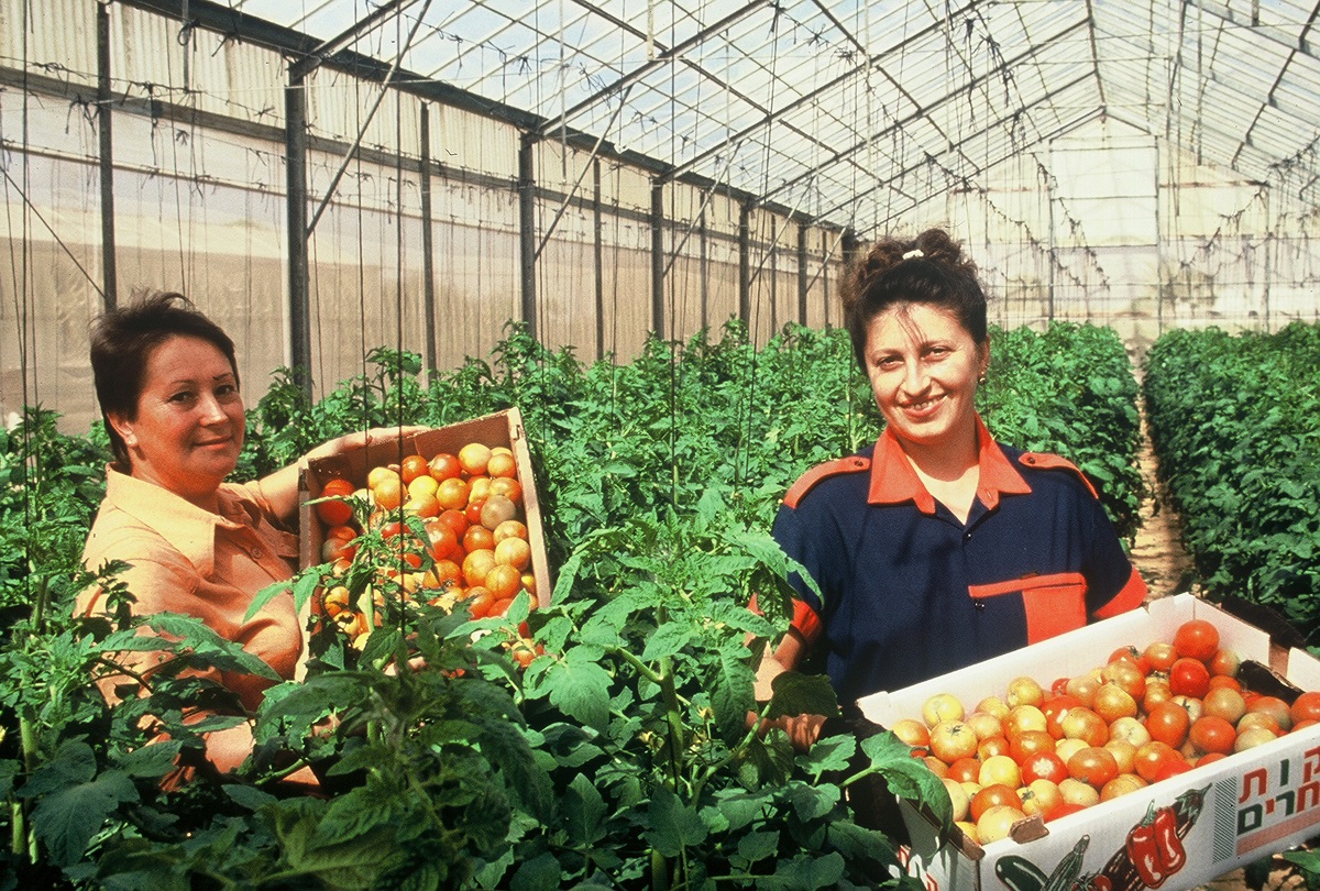
Greenhouse, Negev, Israel
All images © Zion Ozeri. All Rights Reserved.
It has been a goal of Zionist movement to develop the arid Negev, to “make the desert bloom”. This goal has led to extraordinary technological innovation, including the building of greenhouses and the development of drip irrigation, a technique that has been used worldwide.
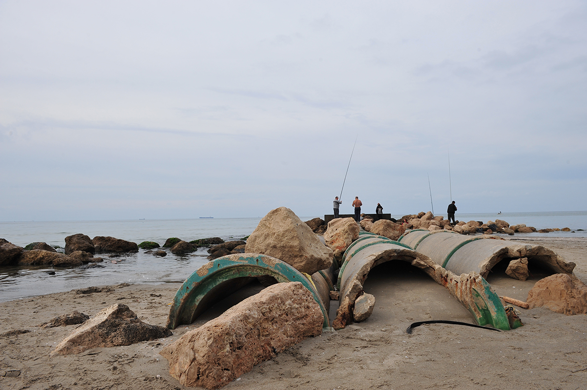
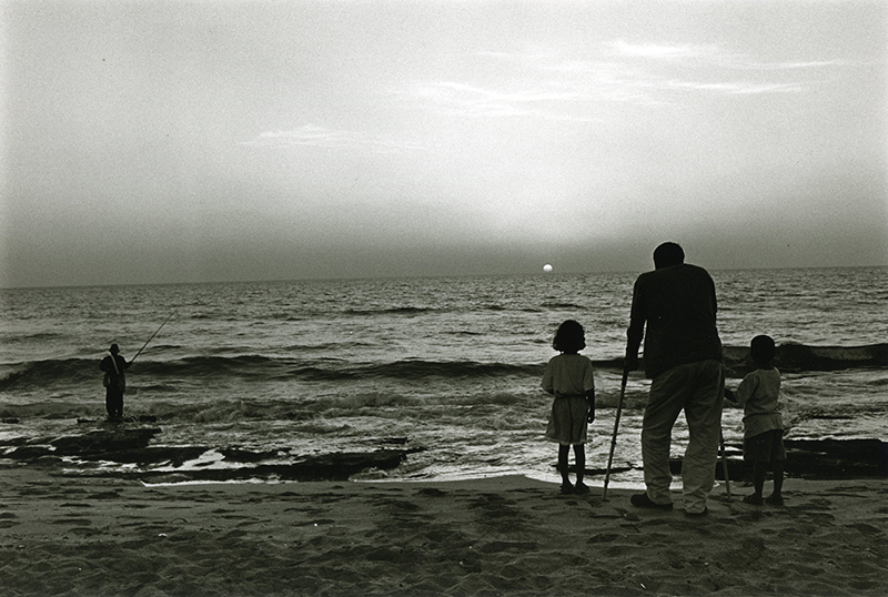
Gone Fishing, Kiryat Yam, Israel 2010
All images © Zion Ozeri. All Rights Reserved.
Fishermen stand on defunct sewer pipes on the Mediterranean Sea, fishing. The pipes are a reminder of Israel’s ongoing efforts in the areas of sustainable growth and development.
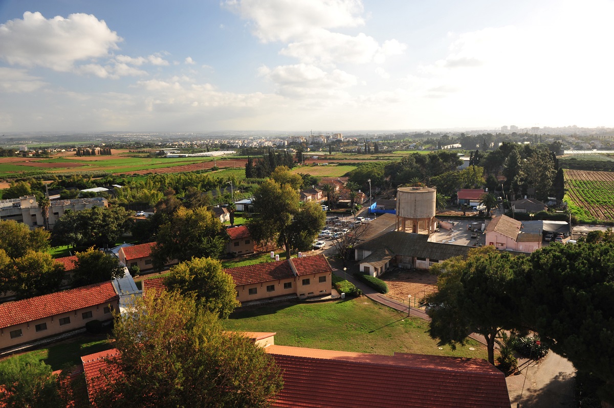
Bet Berl, Israel 2002
All images © Zion Ozeri. All Rights Reserved.
Bet Berl is a college near Kfar Saba, named for Berl Katzenelson. Katzenelson is considered the spiritual leader of the early Labor Movement.
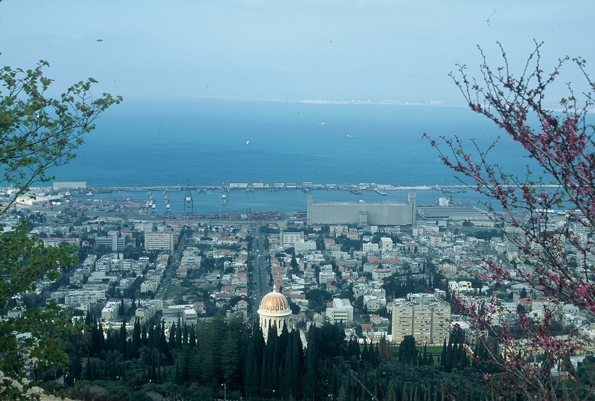
Haifa, Israel 2000
All images © Zion Ozeri. All Rights Reserved.
This photograph offers a view of the port of Haifa, with the Baha’i Temple & Gardens in the foreground. The Baha’i faith was founded in Persia in the 19th century and has about 5 million adherents worldwide. The elaborate Baha’i Gardens in Haifa are a popular tourist destination.

Ha-Kinneret, Israel
All images © Zion Ozeri. All Rights Reserved.
The Kinneret, also known as the Sea of Galilee, is located in the north of Israel. The Kinneret is Israel’s largest lake and provides much of the country’s drinking water.
Palmachim Beach, Israel 2002
All images © Zion Ozeri. All Rights Reserved.
The popular Palmachim Beach is located on the Mediterranean coast of central Israel. The area is named for the Palmach, (Hebrew acronym for Plugot Mahatz, literally, “strike forces”) an elite unit of the Haganah, the underground Jewish army in pre-state Israel.
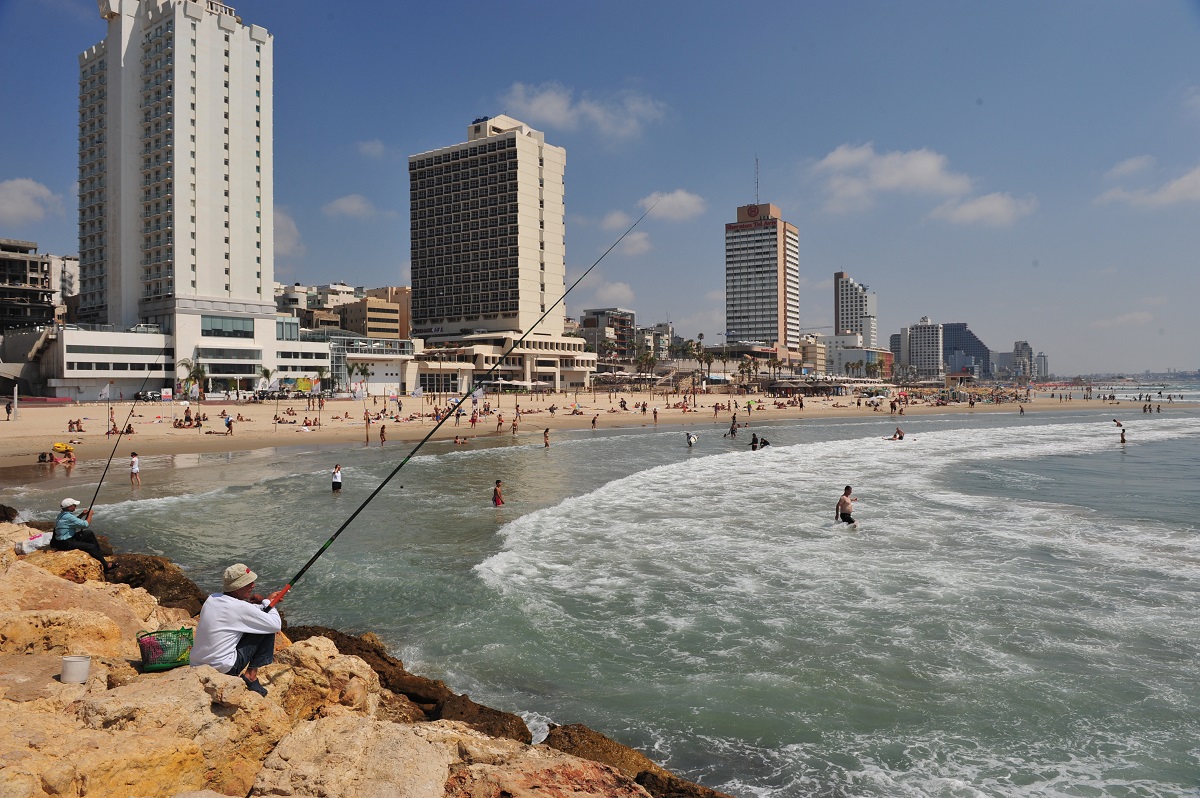
City by the Sea, Tel-Aviv, Israel 2009
All images © Zion Ozeri. All Rights Reserved.
The city of Tel-Aviv offers a unique combination of cosmopolitan life, art, and culture alongside some of the area’s best beaches. High-rise hotels line the Mediterranean Coast along the west side of the city.
Sunset, Nahariya, Israel 1995
All images © Zion Ozeri. All Rights Reserved.
The Mediterranean Sea (Israel coastal plain) extends 187 kilometers (116 miles), north to south, with sandy beaches and Mediterranean climate.
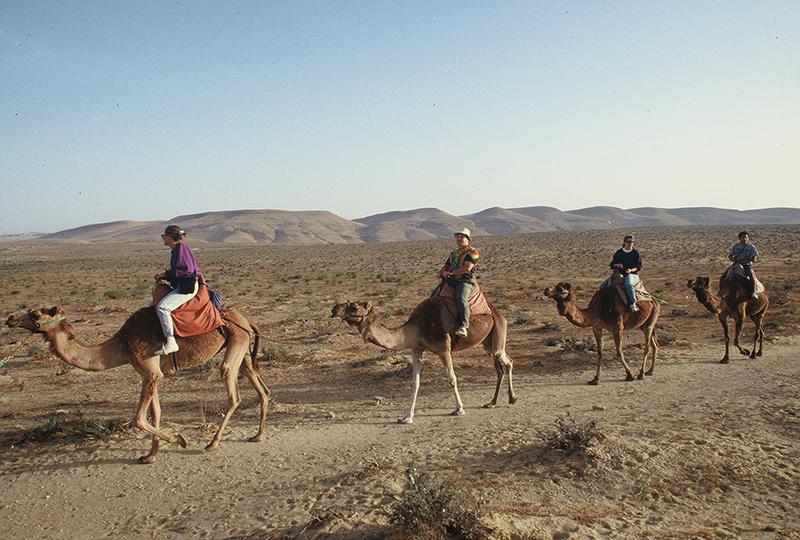
Tourists, Negev, Israel, 2005
All images © Zion Ozeri. All Rights Reserved.
The Negev in southern Israel is more than just a desert. From Eilat in the south to Mitzpeh Ramon, Sde Boker, and the city of Be’er Sheva, the Negev offers a variety of attractions for tourists, including beaches, nature, archaeology, history, and of course, camel rides.
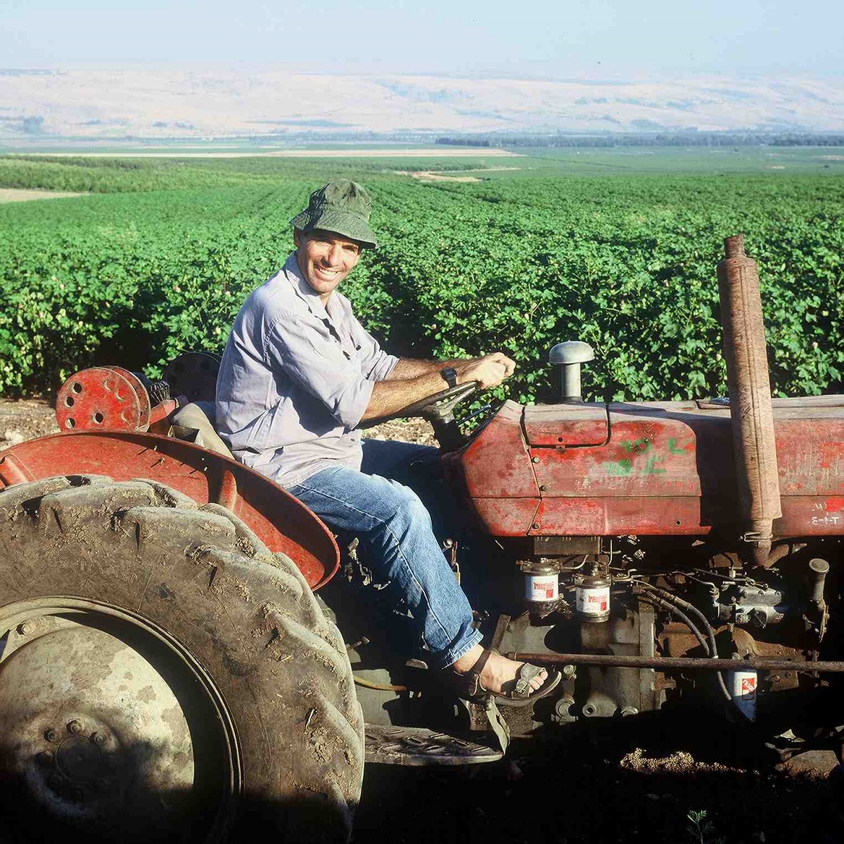
Farmer, Eastern Galilee, Israel 1997
All images © Zion Ozeri. All Rights Reserved.
The Galilee, in northern Israel, is the country’s most fertile agricultural region. It is also known for its beautiful rolling hills and valleys.
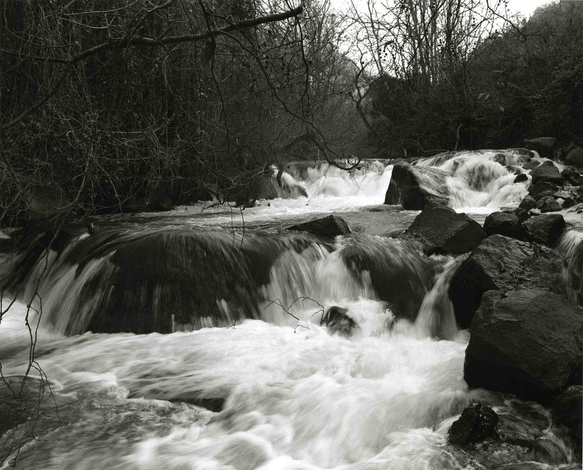
The Dan River, Israel 2002
All images © Zion Ozeri. All Rights Reserved.
The Dan River in the Golan Heights is one of the Jordan River’s three tributaries, along with the Hatzbani and the Banias. Fed by rains and snowmelt from Mount Hermon, the Dan River Valley is lush and green, especially in the springtime.
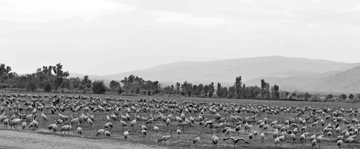
Migrating Birds, Hula Valley, Israel 2012
All images © Zion Ozeri. All Rights Reserved.
Thousands of migratory birds make a stop in the Hula Valley. The Hula Valley is north of the Kinneret (Sea of Galilee), the Golan Heights are visible in the background of the image.
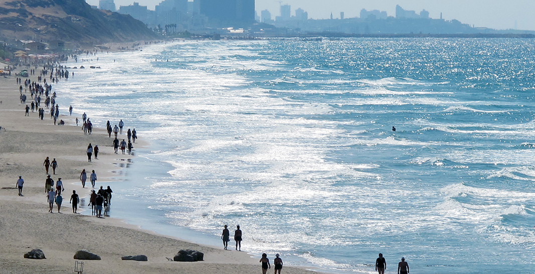
Saturday Morning Walk, Hertzeliya, Israel 2010
All images © Zion Ozeri. All Rights Reserved.
The beach in Hertzeliya is crowded with local residents enjoying the city’s sandy shores.